Using Elevation Contours to Find Tell Madaba
Installed on 03 Apr 2011. Latest update 24 Apr 2019.
(Title was changed on 17 April 2011.)
Text updates or additions are in bold.
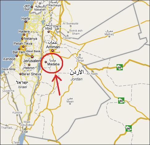
Map of Israel and Jordan showing location of Madaba |
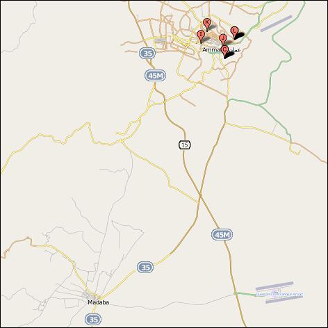
Highways in vicinity of Amman and Madaba |
|
If you use Google Earth to view Madaba at Lat 31º 43' N, Long 35º 48' E, you might be
hard pressed to see where the mound of Tell Madaba is located. Thats's because the
city has grown up all around it. Here is a Google Earth image of Madaba with photograph locations turned off.
|
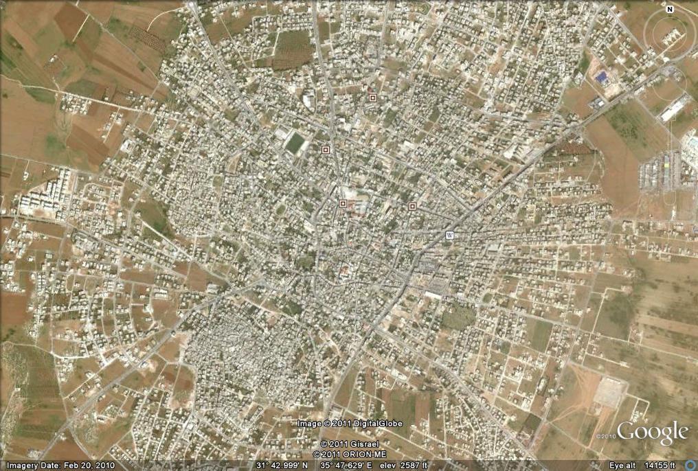
Google Earth image of Madaba, Jordan
|
To call attention to the Tell, I used Google Earth's elevation readout along with its Add Path
function to create elevation contours spaced at 25 feet intervals. After doing this, it becomes
apparent where the mound is. According to the Google Earth Digital Elevation Model (GE DEM) the
highest elevation on the mound is 2624 feet (800 meters). On the image below, the mound is
coincident with the ovoid contour line in the center of the black one-mile-square box.
|
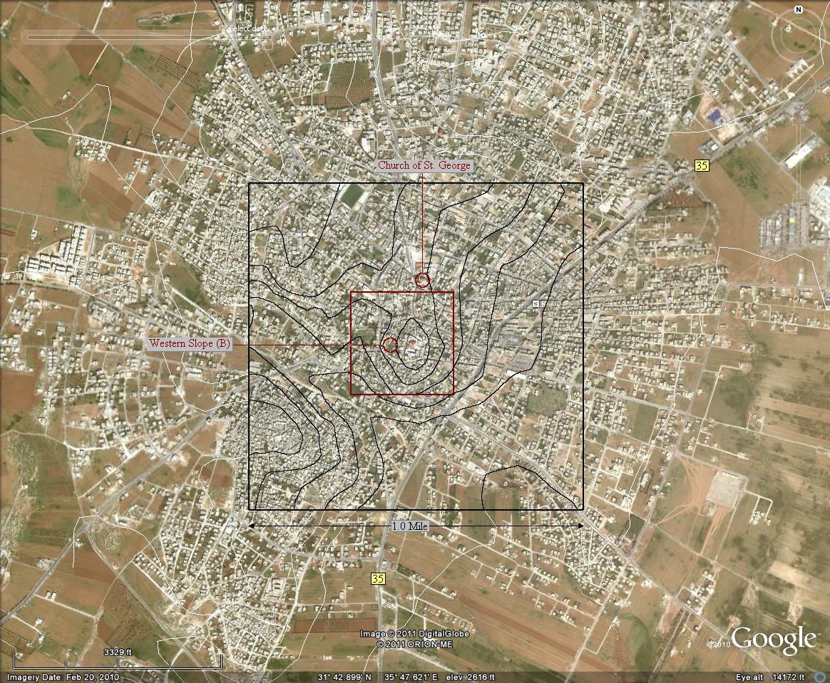
Annotated Google Earth image of Madaba, Madaba Governorate, Jordan
|
The coordinates of the highest point of the mound are 31º 42' 53" N, 35º 47' 36" E. The border of the http://www.utoronto.ca/tmap/ Tell Madaba Archaeological Project (TMAP) area of interest is identified by the dark-red square.- [Link needs update.] The following two maps are copied from the http://www.utoronto.ca/tmap/prelim_1996.html#Intro TMAP Preliminary Report - 1996 Field Season - [Link needs update] |
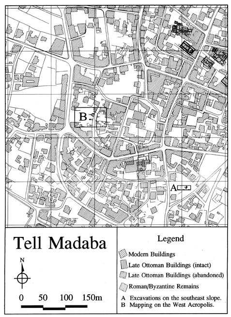 Figure 1
|
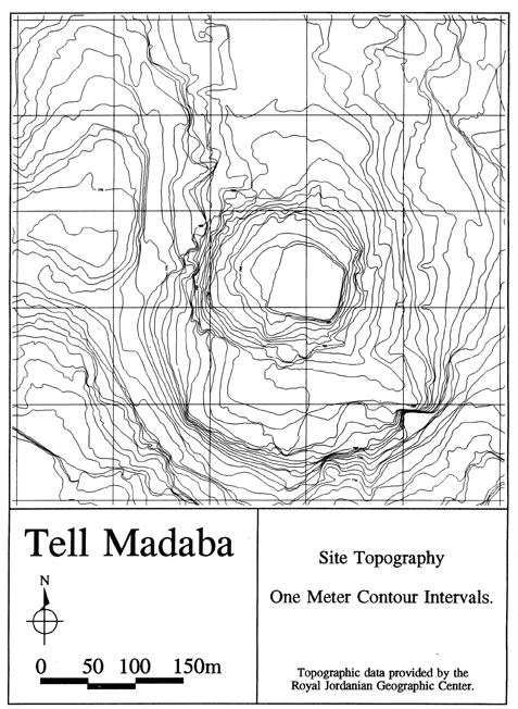 Figure 2
|
Related ArticlesThe Other Herodium Comments on E. J. Vardaman's "The Other Herodium" |
Home | Up one level | Previous | Next